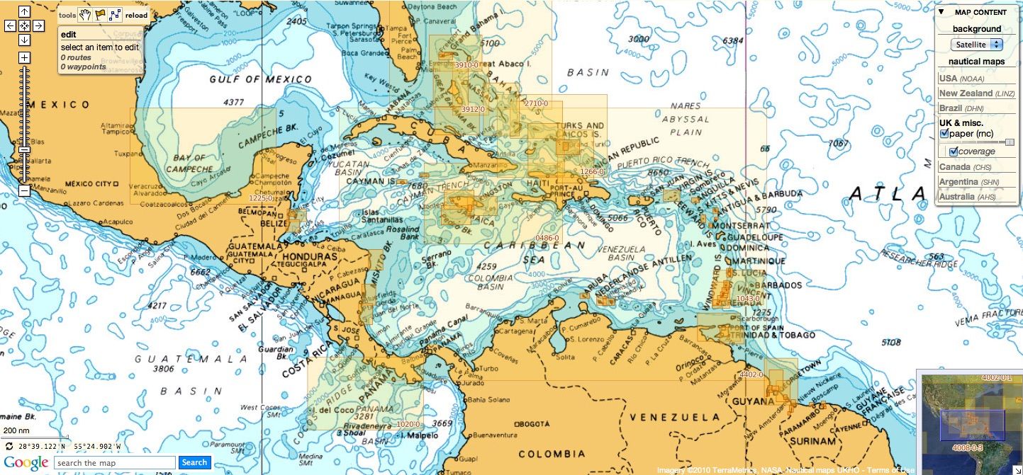
UK & miscellaneous update
Today 950 charts ( 1814 including sub-charts) from UKHO
are available in the 'UK & misc.' chart layer
regrouping charts for different countries :
18 charts have been withdrawn since the last update :
- 85 Spain - south west coast, Rio Guadalquivir
- 663 Tanzania, Approaches to Tanga
- 700 Maiana to Marakei
- 713 Port Louis and Grande Riviere Noire Bay
- 743 Abemama
- 755 Abaiang
- 767 Tabiteuea South Lagoon
- 768 Plans in the Gilbert Islands
- 813 Colombo to Sangama Kanda Point
- 886 Estrecho de la Bocayna and Approaches to Arrecife
- 2006 West Indies, Virgin Islands, Anegada to Saint Thomas
- 2971 Fanning Island
- 3179 UAE and Qatar, Jazirat Das to Ar Ru' Ays
- 3265 Weligama to Little Basses Reef
- 3492 Eastern Approaches to Yell Sound, Colgrave Sound and Bluemull Sound
- 3573 Grandidier Channel
- 3951 Sir Bani Yas to Khawr al `Udayd
- 4634 Frederick Reefs to Solomon Islands
11 charts have been withdrawn since the last update :
- 445 Antartica - Graham Land, Lemaire Channel
- 448 Antartica - Graham Land, Pendleton Strait to Harrison Passage
- 451 International Chart Series, Antarctica - Graham Land, Grandidier Channel
- 455 Tarabulus (Tripoli) Harbour
- 730 Maiana to Marakei
- 1404 Scotland - West Coast, Loch Ryan
- 2976 Approaches to Rio Guadalquivir
- 2977 Rio Guadalquivir - Cano de Enriquez to Cano de San Carlos
- 2978 Rio Guadalquivir, Cano de San Carlos to Punta de la Lisa
- 2979 Rio Guadalquivir - Punta de la Lisa to Coria del Rio
- 2980 Rio Guadalquivir - Huerta del Rincon to Sevilla
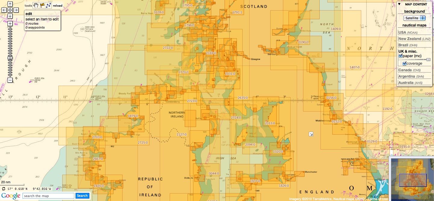
UK
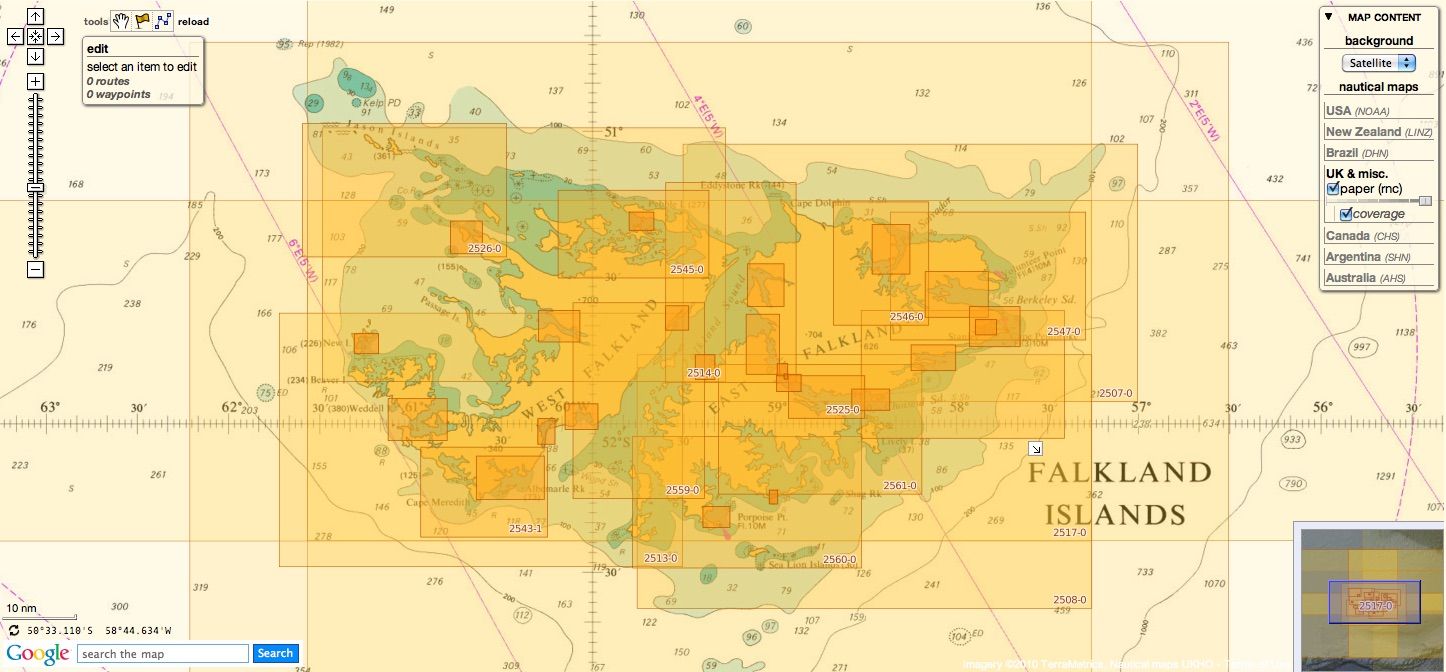
Argentina
24 charts
- 226 International Chart Series, Antarctica - South Shetlands Islands, Deception Island.
- 227 Church Point to Cape Longing including James Ross Island
- 531 Plans on the Coast of Argentina
- 552 Plans on the Coast of Argentina
- 557 Mar del Plata to Comodoro Rivadavia
- 1302 Cabo Guardian to Punta Nava
- 1331 Argentina, Approaches to Bahia Blanca
- 1332 Isla de los Estados and Estrecho de le Maire
- 1751 Puerto de Buenos Aires
- 1982B Rio Parana - Rosario to Parana
- 2505 Approaches to the Falkland Islands
- 2517 North-Western Approaches to the Falkland Islands
- 2519 South-Western Approaches to the Falkland Islands
- 3065 Punta Piedras to Quequen
- 3066 Quequen to Rio Negro
- 3067 Rio Negro to Isla Leones
- 3106 Isla Leones to Pto San Julian
- 3213 Plans in Graham Land
- 3560 Gerlache Strait Northern Part
- 3566 Gerlache Strait Southern Part
- 3755 Bahia Blanca
- 4063 Bellingshausen Sea to Valdivia
- 4200 Rio de la Plata to Cabo de Hornos
- 4207 Falkland Islands to Cabo Corrientes and Northeast Georgia Rise
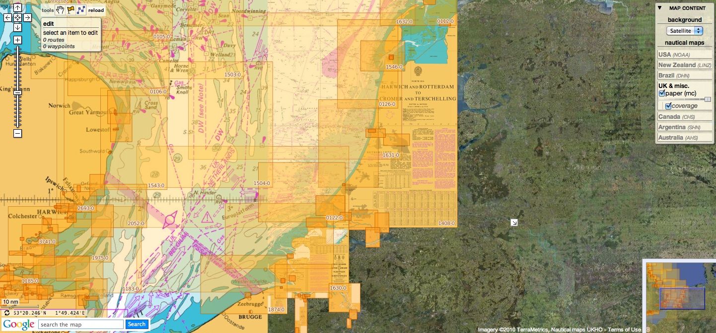
Belgium & Netherlands
27 charts
- 99 Entrances to Rivers in Guyana and Suriname
- 110 Westkapelle to Stellendam and Maasvlakte
- 112 Terschellinger Gronden to Harlingen
- 120 Westerschelde - Vlissingen to Baalhoek and Gent - Terneuzen Canal
- 122 Approaches to Europoort and Hoek van Holland
- 124 Noordzeekanaal including Ijmuiden, Zaandam and Amsterdam
- 125 North Sea Netherlands - Approaches to Scheveningen and Ijmuiden
- 126 North Sea, Netherlands, Approaches to Den Helder
- 128 Westerschelde, Valkenisse to Wintam
- 207 Hoek Van Holland to Vlaardingen
- 208 Rotterdam, Nieuwe Maas and Oude Maas
- 209 Krimpen a/d Lek to Moerdijk
- 266 North Sea Offshore Charts Sheet 11
- 572 Essequibo River to Corentyn River
- 702 Nederlandse Antillen, Aruba and Curacao
- 1187 Outer Silver Pit
- 1408 North Sea, Harwich and Rotterdam to Cromer and Terschelling.
- 1412 Caribbean Sea - Nederlandse Antillen, Ports in Aruba and Curacao
- 1414 Bonaire
- 1503 Outer Dowsing to Smiths Knoll including Indefatigable Banks.
- 1504 Cromer to Orford Ness
- 1546 Zeegat van Texel and Den Helder Roads
- 1630 West Hinder and Outer Gabbard to Vlissingen and Scheveningen
- 1631 DW Routes to Ijmuiden and Texel
- 1632 DW Routes and Friesland Junction to Vlieland
- 1874 North Sea, Westerschelde, Oostende to Westkapelle
- 2047 Approaches to Anguilla
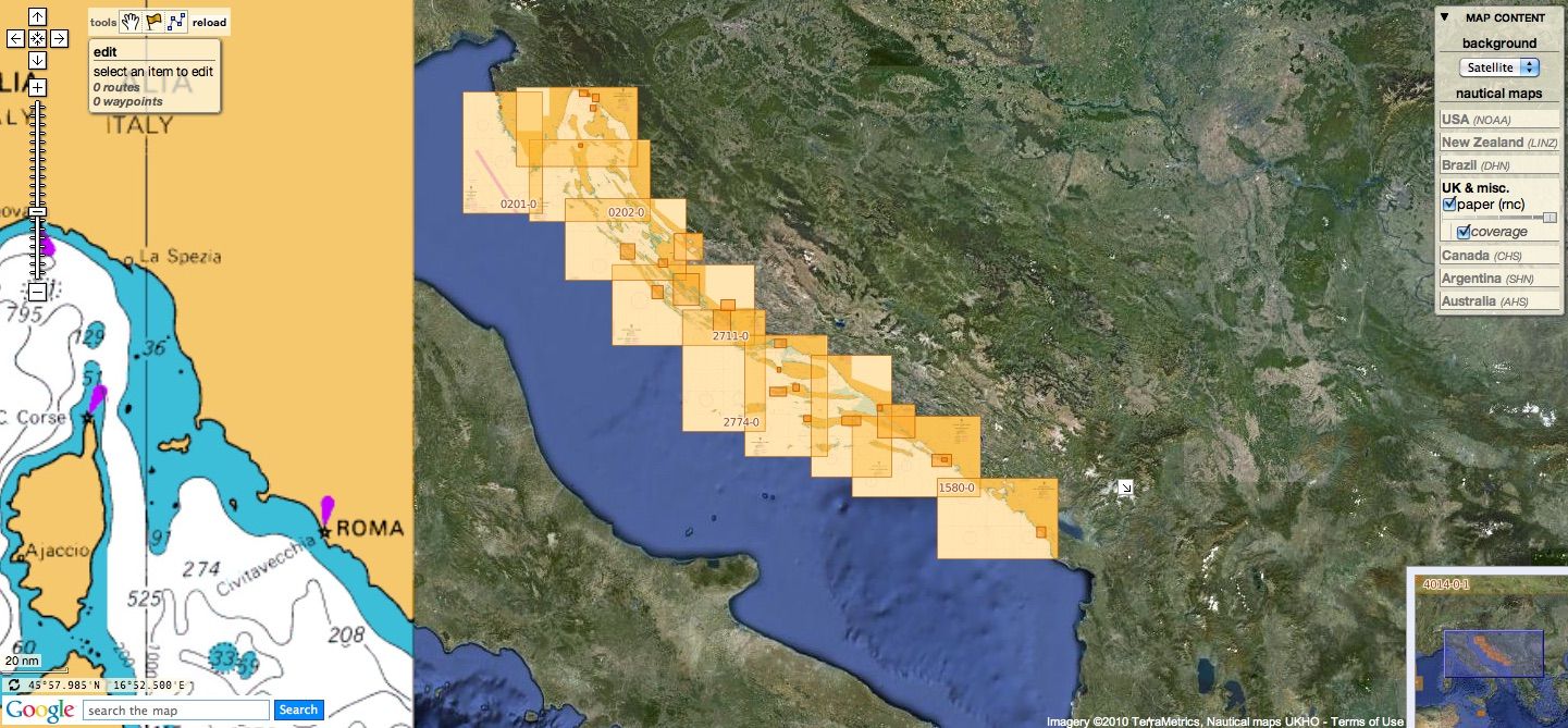
Croatia
13 charts
- 201 Rt Kamenjak to Novigrad
- 202 Kvarner, Kvarneric and Velebitski Kanal
- 269 Ploce and Split with Adjacent Harbours, Channels and Anchorages
- 515 Zadar to Luka Mali Losinj
- 680 Dubrovnik
- 1574 Otok Glavat to Ploce and Makarska
- 1580 Otocic Veliki Skolj to Otocic Glavat
- 1996 Ports in Rijecki Zaljev
- 2711 Rogoznica to Zadar
- 2712 Otok Susac to Split
- 2719 Rt Marlera to Senj including Approaches to Rijeka
- 2773 Sibenik, Pasmanski Kanal, Luka Telascica, Sedmovrace, Rijeka Krka
- 2774 Otok Vis to Sibenik
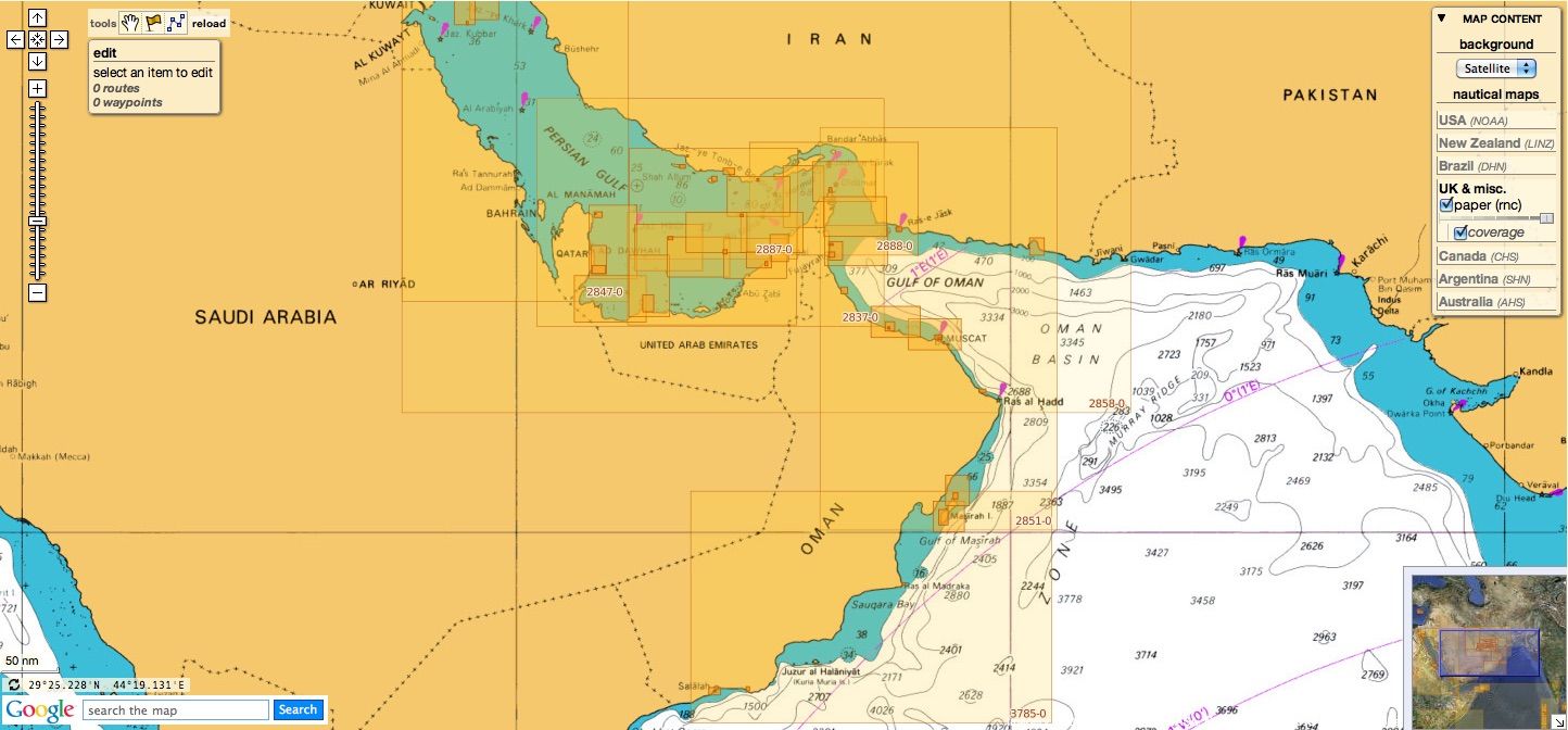
Oman
7 charts
- 2853 Gulf of Oman, approaches to Sohar
- 2854 Northern approaches to Masirah
- 3171 Southern Approaches to the Strait of Hormuz
- 3409 Plans in Iran, Oman and the United Arab Emirates
- 3511 Wudam and Approaches
- 3518 Ports and Anchorages on the North East Coast of Oman
- 3762 Oman - South East coast, Ad Duqm
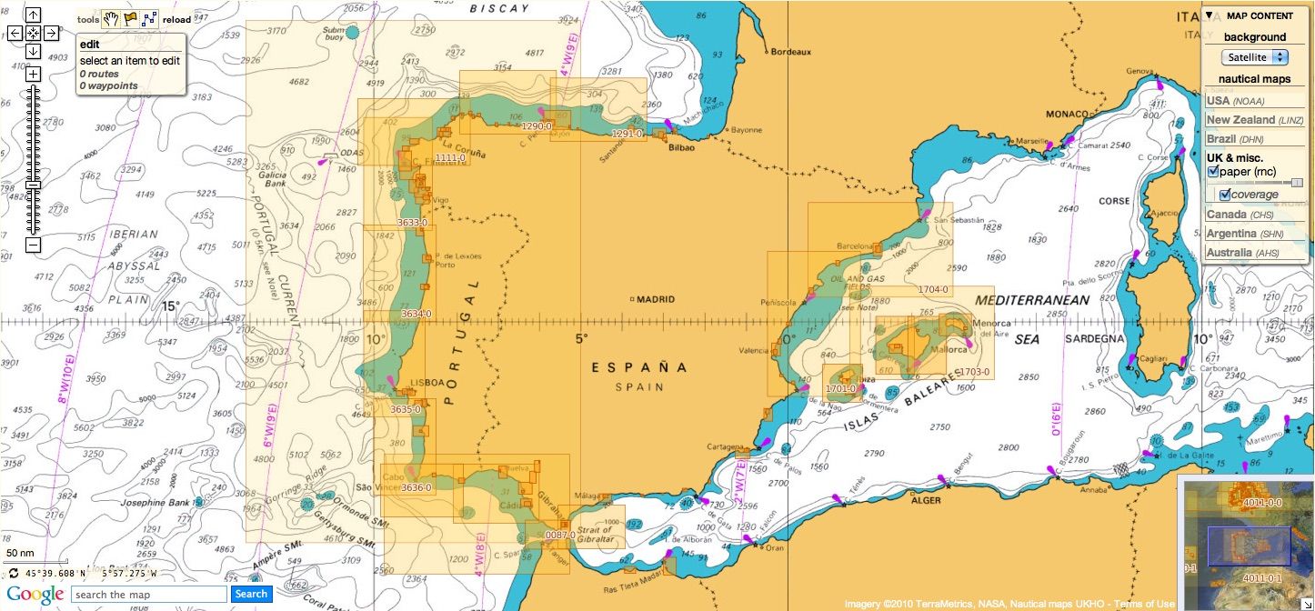
Spain & Portugal
129 charts
- 45 Gibraltar Harbour
- 73 Puerto de Huelva and Approaches
- 83 Ports on the South Coast of Portugal
- 86 Bahia de Cadiz
- 87 Cabo Finisterre to the Strait of Gibraltar
- 88 Cadiz
- 89 Cabo de Sao Vicente to Faro
- 91 Cabo de Sao Vicente to the Strait of Gibraltar
- 93 Cabo de Santa Maria to Cabo Trafalgar
- 142 Strait of Gibraltar
- 144 Mediterranean Sea, Gibraltar
- 307 Angola, Cabeca da Cobra to Cabo Ledo
- 308 Angola, Cabo Ledo to Lobito
- 309 Lobito to Ponta Grossa
- 312 Luanda to Baia dos Tigres
- 366 Arquipelago de Cabo Verde
- 469 Alicante
- 473 Approaches to Alicante
- 518 Spain East Coast, Approaches to Valencia
- 562 Mediterranean Sea, Spain - East Coast, Valencia.
- 580 Al Hoceima, Melilla and Port Nador with Approaches
- 659 Angola, Port of Soyo and Approaches
- 690 Cabo Delgado to Mikindani Bay
- 1094 Rias de Ferrol, Ares, Betanzos and La Coruna
- 1096 Ribadeo
- 1110 La Coruna and Approaches
- 1111 Punta de la Estaca de Bares to Cabo Finisterre
- 1113 Harbours on the North-West Coast of Spain
- 1117 Puerto de Ferrol
- 1118 Ria de Ferrol
- 1122 Ports on the North Coast of Spain
- 1133 Ports on the Western Part of the North Coast of Spain
- 1142 Ria de Aviles
- 1145 Spain - North Coast, Santander
- 1150 Ports on the North Coast of Spain
- 1153 Approaches to Gijon
- 1154 Spain, north coast, Gijon
- 1157 Pasaia (Pasajes) and Approaches
- 1172 Puertos de Bermeo and Mundaka
- 1173 Spain - North Coast, Bilbao
- 1174 Approaches to Bilbao
- 1180 Barcelona
- 1189 Approaches to Cartagena
- 1193 Spain - east coast, Tarragona
- 1194 Cartagena
- 1196 Approaches to Barcelona
- 1197 Plans on the West Coast of Africa
- 1215 Plans on the Coast of Angola
- 1216 Baia dos Tigres
- 1290 Cabo de San Lorenzo to Cabo Ortegal
- 1291 Santona to Gijon
- 1448 Gibraltar Bay
- 1453 Gandia
- 1455 Algeciras
- 1460 Sagunto
- 1514 Spain - East Coast, Castellon
- 1515 Ports on the East Coast of Spain
- 1589 Almeria
- 1595 Ilhas do Principe, de Sao Tome and Isla Pagalu
- 1684 Ilha da Madeira, Manchico and Canical
- 1685 Ilha de Madeira, Ponta Gorda de Sao Lourenco including the Port of Funchal
- 1689 Ports in the Arquipelago da Madeira
- 1701 Cabo de San Antonio to Vilanova I la Geltru including Islas de Ibiza and Formentera
- 1703 Mallorca and Menorca
- 1704 Punta de la Bana to Islas Medas
- 1724 Canal do Geba and Bissau
- 1726 Approaches to Canal do Geba and Rio Cacheu
- 1727 Bissau, Bolama and Approaches
- 1730 Spain - West Coast, Ria de Vigo
- 1731 Vigo
- 1732 Spain - West Coast, Ria de Pontevedra
- 1733 Spain - West Coast, Marin and Pontevedra
- 1734 Approaches to Ria de Arousa
- 1740 Livingston Island, Bond Point to Brunow Bay including Juan Carlos 1 Base and Half Moon Island
- 1755 Plans in Ria de Arousa
- 1756 Ria de Muros
- 1762 Vilagarcia de Arosa
- 1764 Ria de Arousa
- 1831 Arquipelago da Madeira
- 1847 Santa Cruz de Tenerife
- 1850 Approaches to Malaga
- 1851 Malaga
- 1854 Motril and Adra
- 1856 Approaches to Puerto de La Luz (Las Palmas)
- 1858 Approaches to Santa Cruz de Tenerife, Puerto de San Sebastian de la Gomera, Santa Cruz de la Palma and Approaches
- 1861 North Atlantic Ocean – Islas Canarias, Gran Canaria to El Hierro
- 1862 North Atlantic Ocean – Islas Canarias, Lanzarote to Cabo Bojador
- 1863 Islas Canarias, Puerto de los Marmoles to Puerto del Rosario
- 1895 Ilha de Sao Miguel
- 1950 Arquipelago dos Acores
- 1956 Arquipelago dos Acores Central Group
- 1957 Harbours in the Arquipelago Dos Acores (Central Group)
- 1959 Flores,Corvo and Santa Maria with Banco Das Formigas
- 2742 Cueta
- 2761 Menorca
- 2762 Menorca, Mahon
- 2831 Punta Salinas to Cabo de Formentor including Canal de Menorca
- 2832 Punta Salinas to Punta Beca including Isla de Cabrera
- 2834 Ibiza and Formentera
- 2932 Cabo de Sao Sebastiao to Beira
- 2934 Africa - east coast, Mozambique, Beira to Rio Zambeze
- 2935 Quelimane to Ilha Epidendron
- 2976 Approaches to Rio Guadalquivir NEW
- 2977 Rio Guadalquivir - Cano de Enriquez to Cano de San Carlos NEW
- 2978 Rio Guadalquivir, Cano de San Carlos to Punta de la Lisa NEW
- 2979 Rio Guadalquivir - Punta de la Lisa to Coria del Rio NEW
- 2980 Rio Guadalquivir - Huerta del Rincon to Sevilla NEW
- 3034 Approaches to Palma
- 3035 Palma
- 3220 Entrance to Rio Tejo including Baia de Cascais
- 3221 Lisboa, Paco de Arcos to Terreiro do Trigo
- 3222 Lisboa, Alcantara to Canal do Montijo
- 3224 Approaches to Sines
- 3227 Aveiro and Approaches
- 3228 Approaches to Figueira da Foz
- 3257 Viana do Castelo and Approaches
- 3258 Approaches to Leixoes and Barra do Rio Douro
- 3259 Approaches to Setubal
- 3260 Carraca to Ilha do Cavalo
- 3291 Angola, (Cabinda), Cabinda and Malongo Terminals
- 3448 Plans in Angola
- 3578 Eastern Approaches to the Strait of Gibraltar
- 3633 Islas Sisargas to Rio Mino
- 3634 Montedor to Cabo Mondego
- 3635 Cabo Mondego to Cabo Espichel
- 3636 Cabo Espichel to Cabo de Sao Vicente
- 3764 Cabo Torinana to Punta Carreiro
- 4114 Arquipelago dos Acores to Flemish Cap
- 4115 Arquipelago dos Acores to the Arquipelago de Cabo Verde
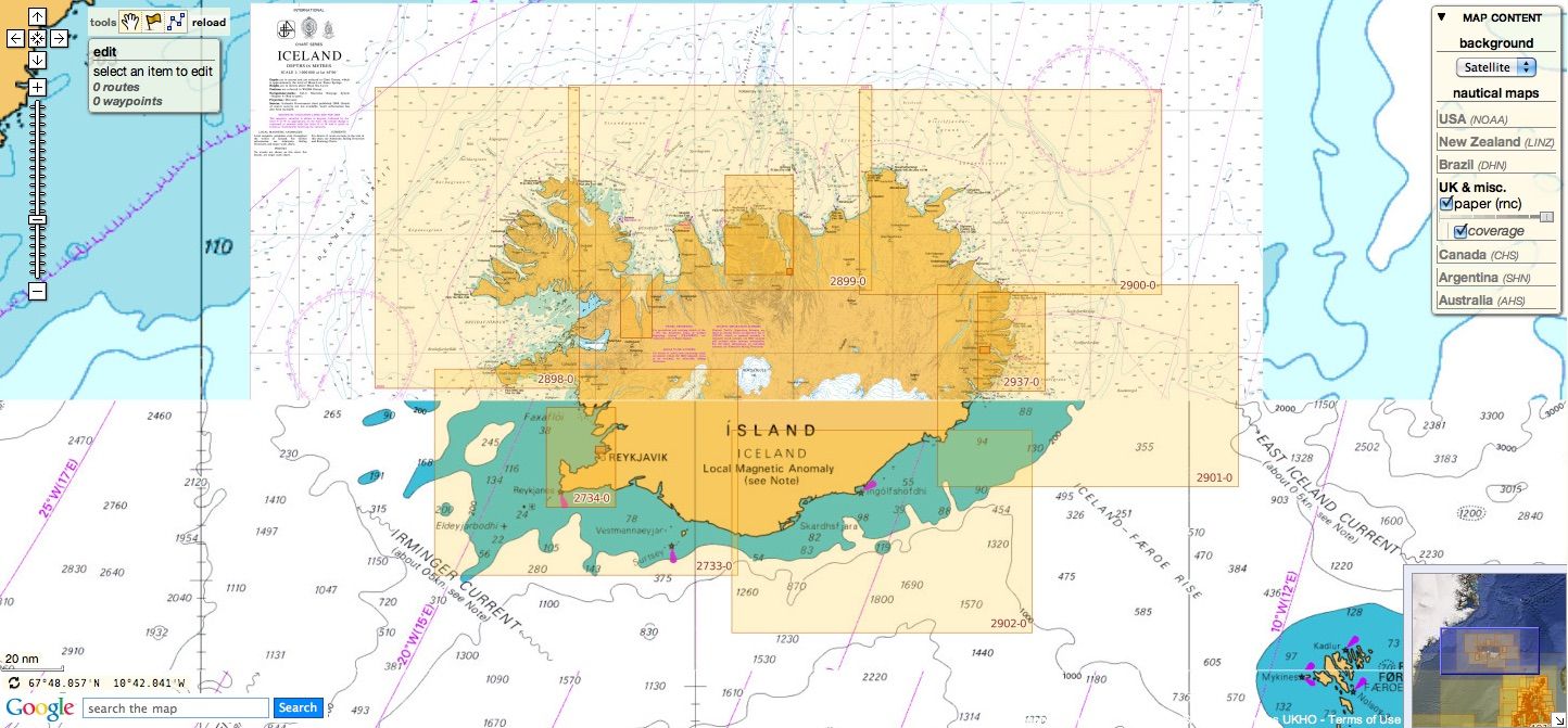
Iceland
14 charts
- 2733 Dyrholaey to Snaefellsjokull
- 2734 Approaches to Reykjavik
- 2735 Iceland - South West Coast, Reykjavik
- 2897 Iceland
- 2898 Vestfirdir
- 2899 Iceland, Noth Coast, Horn to Rauoinupur
- 2900 Iceland, North East Coast, Rauoinupur to Glettinganes
- 2901 Iceland, East Coast, Glettinganes to Stokksnes
- 2902 Stokksnes to Dyrholaey
- 2955 Iceland, North Coast, Akureyri
- 2956 Iceland, North Coast, Eyjafjordur
- 2937 Hlada to Glettinganes
- 2938 Reydarfjordur
- 4112 North Atlantic Ocean, Iceland to Greenland
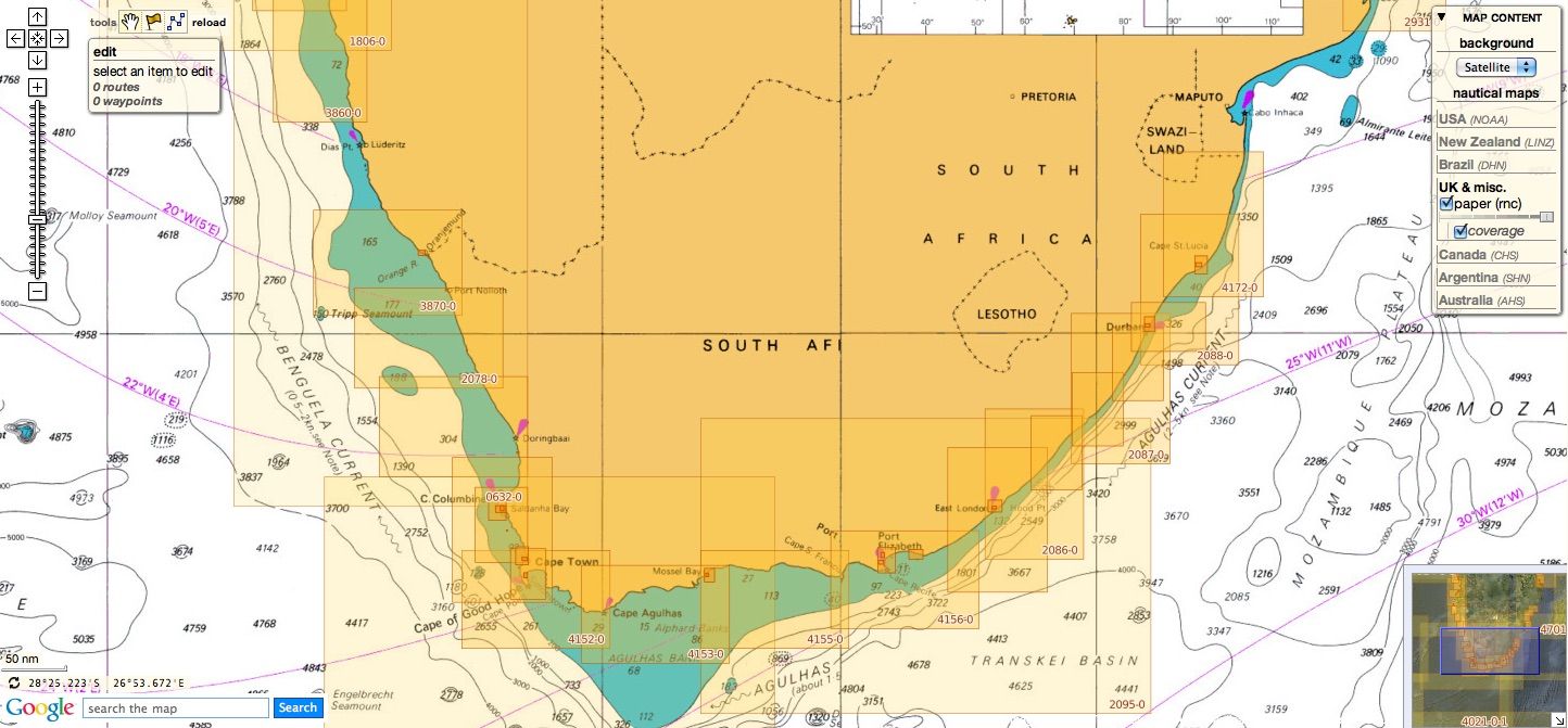
South Africa
49 charts
- 578 Cape Columbine to Cape Seal
- 632 Hollandsbird Island to Cape Columbine
- 643 Durban Harbour
- 665 Approaches to Zanzibar
- 1236 Saldanha Bay
- 1806 Baia dos Tigres to Conception Bay
- 1846 Table Bay Docks and Approaches
- 1922 RSA - Simon's Bay
- 2078 Port Nolloth to Island Point
- 2095 Cape St Blaize to Port S. John's
- 3211 Zanzibar Harbour
- 3793 Shixini Point to Port S Johns
- 3794 Port S Johns to Port Shepstone
- 3795 Port Shepstone to Cooper Light
- 3797 Green Point to Tongaat Bluff
- 3859 Cape Cross to Conception Bay
- 3860 Mutzel Bay to Spencer Bay
- 3861 Namibia, Approaches to Luderitz
- 3869 Hottentot Point to Chamais Bay
- 3870 Chamais Bay to Port Nolloth
- 4132 Kunene River to Sand Table Hill
- 4133 Sand Table Hill to Cape Cross
- 4136 Harbours on the West Coasts of Namibia and South Africa
- 4141 Island Point to Cape Deseada
- 4142 Saldanha Bay Harbour
- 4145 Approaches to Saldanha Bay
- 4146 Cape Columbine to Table Bay
- 4148 Approaches to Table Bay
- 4150 Republic of South Africa, South West Coast, Table Bay to Valsbaai
- 4151 Cape Deseada to Table Bay
- 4152 Republic of South Africa, South West Coast, Table Bay to Cape Agulhas
- 4153 Republic of South Africa, South Coast, Cape Agulhas to Cape St. Blaize
- 4154 Mossel Bay
- 4155 Cape St Blaize to Cape St Francis
- 4156 South Africa, Cape St Francis to Great Fish Point
- 4157 South Africa, Approaches to Port Elizabeth
- 4158 Republic of South Africa - South Coast, Plans in Algoa Bay.
- 4159 Great Fish Point to Mbashe Point
- 4160 Ngqura Harbour
- 4162 Approaches to East London
- 4163 Republic of South Africa, South East Coast, Mbashe Point to Port Shepstone
- 4170 Approaches to Durban
- 4171 Republic of South Africa – South East Coast, Port Shepstone to Tugela River
- 4172 Tugela River to Ponta do Ouro
- 4173 Approaches to Richards Bay
- 4174 Richards Bay Harbour
- 4204 Walvis Bay to Maputo
- 4205 Agulhas Plateau to Discovery Seamounts
- 4700 Port Elizabeth to Mauritius
Malta
5 charts
- 36 Marsaxlokk
- 177 Valletta Harbours
- 211 Plans in the Maltese Islands
- 2537 Ghawdex (Gozo), Kemmuna (Comino) and the Northern Part of Malta
- 2538 Malta
NGA
52 international charts
- 3 Chagos Archipelago
- 82 Outer Approaches to Port Sudan
- 100 Raas Caseyr to Suqutra
- 255 Eastern Approaches to Jamaica
- 256 Western Approaches to Jamaica
- 260 Pedro Bank to the South Coast of Jamaica
- 333 Offshore Installations in the Gulf of Suez
- 334 North Atlantic Ocean, Bermuda
- 386 Yadua Island to Yaqaga Island
- 390 Bahamas, Grand Bahama Island, Approaches to Freeport
- 398 Grand Bahama Island, Freeport Roads, Freeport Harbour
- 457 Portland Bight
- 462 The Cayman Islands
- 486 Jamaica and the Pedro Bank
- 501 South East Approaches to Trinidad
- 868 Eastern and Western Approaches to The Narrows including Murray's Anchorage
- 920 Chagos Archipelago, Diego Garcia
- 928 Sulu Archipelago
- 959 Colson Point to Belize City including Lighthouse Reef and Turneffe Islands
- 1043 Saint Lucia to Grenada and Barbados
- 1225 Gulf of Campeche
- 1265 Approaches to Shatt Al 'Arab or Arvand Rud, Khawr Al Amaya and Khawr Al Kafka
- 1450 Turks and Caicos Islands, Turks Island Passage and Mouchoir Passage
- 1638 Plans in Northern Vanuatu
- 2009 Sheet 2 From 23 deg 40 min North Latitude to Old Bahama Channel
- 2065 Northern Antigua
- 2133 Approaches to Suez Bay (Bahr el Qulzum)
- 2373 Bahr el Qulzum (Suez Bay) to Ras Sheratib
- 2374 Ra's Sharatib to Juzur Ashrafi
- 2658 Outer Approaches to Mina` al Jeddah (Jiddah)
- 2837 Strait of Hormuz to Qatar
- 2847 Qatar to Shatt al `Arab
- 3043 Red Sea, Ports on the coast of Egypt.
- 3102 Takoradi and Sekondi Bays
- 3175 Jazirat al Hamra' to Dubai (Dubayy) and Jazireh-ye Sirri
- 3310 Africa - east coast, Mafia Island to Pemba Island
- 3361 Wasin Island to Malindi
- 3432 Saltpond to Tema
- 3493 Red Sea - Sudan, Bashayer Oil Terminals and Approaches.
- 3519 Southern Approaches to Masirah
- 3520 Khawr Kalba and Dawhat Diba to Gahha Shoal
- 3522 Approaches to Masqat and Mina' al Fahl
- 3530 Approaches to Berbera
- 3709 Gulf of Oman, United Arab Emirates, Port of Fujairah (Fujayrah) and Offshore Terminals.
- 3723 Gulf of Oman, United Arab Emirates, Approaches to Khawr Fakkan and Fujairah (Fujayrah).
- 3785 Mina' Raysut to Al Masirah
- 3907 Bahama Islands and Hispaniola, Passages between Mayaguana Island and Turks and Caicos Islands.
- 3908 Passages between Turks and Caicos Islands and Dominican Republic
- 3910 Little Bahama Bank including North West Providence Channel
- 3912 Bahamas, North East Providence Channel and Tongue of the Ocean
- 3913 Bahamas, Crooked Island Passage and Exuma Sound
- 3914 Turks and Caicos Islands and Bahamas, Caicos Passage and Mayaguana Passage
Don't forget to visit the UKHO Notices to Mariners : NTM for 2015